File:SF Tieton Watershed.png
Size of this preview: 381 × 600 pixels. Other resolution: 529 × 833 pixels.
Original file (529 × 833 pixels, file size: 835 KB, MIME type: image/png)
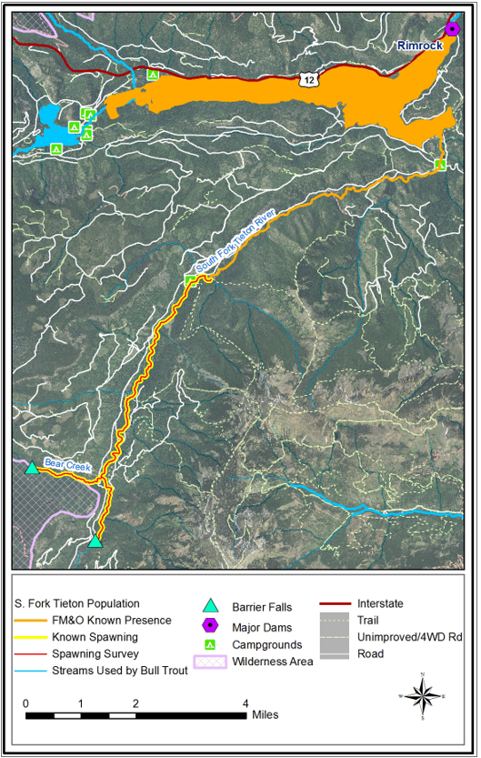
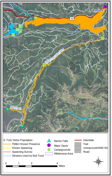
A map of the South Fork Tieton River subwatershed
File history
Click on a date/time to view the file as it appeared at that time.
| Date/Time | Thumbnail | Dimensions | User | Comment | |
|---|---|---|---|---|---|
| current | 15:58, 15 October 2024 | | 529 × 833 (835 KB) | Aconley (talk | contribs) |
You cannot overwrite this file.
File usage
The following page uses this file: